-
#Nature Trails
Location of Start - 40.751535, 0.321370
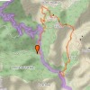
Distance - 7,5km.
Ascent - 535m.
Walking time and total completion time including any stops - 2,5/4,5 hrs.
Start point - Head for Mas de Barberans on the TV3421. From the N pass the village and 3 kms after passing Mas de Barberans turn right (L and before the village if coming from the S), signposted ‘Cami de la Barranc de la Galera and La Vall’. Continue along here as the tarmac vanishes and proceed along a track for 5.2km to reach the parking for Cova d’en Marc where you can leave a car. The picnic parking is a further 1.2km further up the track on the LHS.
Recommendations or Restrictions - Car shuffle needed from the first bridge crossing at the Raco and up to the picnic area further up the track on the LHS. Moderate scrambling from the first col.
An easier but equally rewarding version without scrambling, is a there and back route from the small Raco d’en Marc parking.
| From the picinic car parking area walk back along the track the way you drove in. When you reach a track junction turn L and continue gently uphill. | 1km, 15min |
| Take this and walk more steeply up several zigzags to eventually reach a col. | 2.6km, 40min |
| Just before this look out for a cairn on the R marking a small footpath that you take up the ridge to a small plateau about 50m above. From here carefully follow the red paint marks as they lead you up initially on the LHS of the ridge line but soon crossing to the R. These lead you steeply uphill to reach a series of scrambles which become steadily more serious the higher you go. The final one goes up a rocky gully and swings L to mount a high step and then emerge on a grassy but eroded ledge. If you are a confident scrambler then none of these will be troublesome. From here work up to the ridge line and soon cross to the L flank of the ridge continuing to push uphill avoiding a large rock tower in front of you. Keep going to reach a col on the ridge – your high point of the day - with the Roca Xapada on the RHS and a broad plateau on the LHS with outstanding views of the Barrancs de LLoret and d’Orio- an excellent picnic spot. |
3.9km, 1hr 9min |
| Continue from the col now dropping down to a neck in woodland in front of you. In front of you the large peak is Castell de l'Airosa and you make you way steadily down to a col directly in front of it on the way walking across a narrow ridge with tremendous views down to the pinnacle clad lands in front of the highest summit (with masts) – Caro. | 4.7km, 1hr 28min |
| At this col there is a finger post signed to L'Airosa slightly L but we continue descending slightly R still on a clear path. Eventually cross a small barranco with a finger post in the middle pointing back the way you came and some way beyond this after zig-zagging down for a while you reach a further finger post indicating a cave on the R and Forat on the L. Either of these paths will lead you back down to the track on the valley floor where you left you car. (The gps track takes the path on the L) If you have not parked a vehicle here then turn R up the track and continue for about 1.5km to reach the parking spot. |
6.5km, 2hr 5min |

