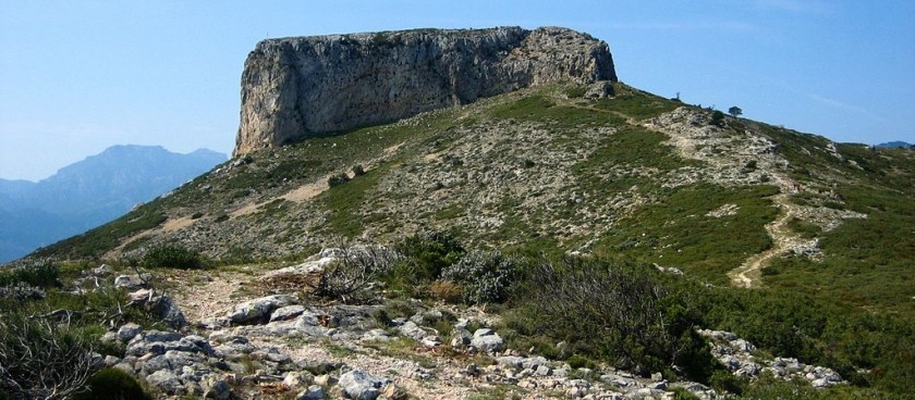
A circular walk through woods and limestone crags to round a rocky ridge and emerge near the top of the Vall d’Infern.

Image source: © en.wikipedia.org
-
#Nature Trails
Location of Start - 40.921850, 0.400144
Distance - 12,4km.
Ascent - 700m.
Walking time and total completion time including any stops - 4.75.5.75hrs.
Start point - From Tortosa take the C12 north for 14km to the junction signed for Xerta and Pauls (the 3rd junction signed for Xerta). At the T-junction turn right for Pauls on the TV3541. After 9kms pass the huge village sign and continue to park at the start of the village main street on the left.
| Leave the parking to drop down past the olive oil co-operative and the rubbish bins and continue on the small road which leads to San Roc. Take the second turn to the left to pass a restored barn. | 0.6km, 5min |
| Continue, descending past ancient olive trees to cross a (usually) dry ford and turn immediately left at a T-junction. Continue for about 5 min and turn right onto a concreted track. | 1.5km, 17min |
| The track climbs steeply past farm buildings and through woodland; becoming rougher as it zig-zags up through terraces and finally reducing down to a footpath. Continue climbing on the path as it widens again and passes a small grassy plantation of olive, almond and cherry trees and emerges at an old farmhouse with a big cistern and stone picnic tables. Walk past the farmhouse to join a forestry track and turn right onto it. | 2.7km, 45min |
| Walk along the track for 8 mins and stay alert for a small path leading up to the left, marked by a cairn. The start of the path is not obvious since it leads back a little. Turn on to it. | 3.1km, 53min |
| Climb and contour for ten minutes or so to reach a junction of paths with a small section of dry stone walling. This is the beginning and end of the circuit. Turn sharply to the left to find the smaller path which rises steeply and will take us climbing and contouring around the end of the ridge. | 3.6km, 1hr |
| The path meanders through woodland, up rocky steps and past cliffs, offering glimpses of the village of Pauls increasingly further below. The route is clear on the ground except for one place, some 15mins after leaving the junction, where vigilance is needed to spot a turn to the right to climb up the hillside more steeply. It is well cairned and easy to see. | 3.9km, 1hr 15min |
| Meandering and undulating to negotiate numerous side valleys and scree-filled barrancs, the path finally tops out and crosses the end of the Montaspre ridge to enter the Vall d’Infern. | 4.9km, 1hr 40min |
| Continue (mostly) descending to arrive at a junction on the floor of the Vall d’Infern and turn right on a clear path which climbs steeply. | 5.3km, 1hr 50mins |
| The gradient eases off as the landscape opens out into a scrubby upland and the path makes its way towards la Moleta. Ibex can frequently be seen from this point on and especially on the grassy flanks below the big rectangular block which forms the La Moleta summit. Follow the path to a T-junction with a signpost and turn right onto the yellow and white waymarked path in the direction of La Moleta. | 6.2km, 2hrs 05mins |
| A short, steep climb leads onto a ridge with extensive views across the river valley. Follow the grassy ridge to the foot of la Moleta and find the iron rungs which lead onto the summit (Optional). | 6.6km, 2hrs 25mins |
| NB The scramble onto the top takes only 5 mins but the views are so good, it is worthwhile lingering. 20mins is allowed in this description. Return carefully to the foot of the block and turn onto the continuation of the yellow and white marked path. | 2hrs 45mins |
| Descend slightly along another ridge path to a signposted junction and continue straight on, climbing to rejoin the Montaspre Ridge at the col between La Coscollosa on the right and the Montaspre on the left. | 7.4km, 3hrs 10mins |
| Soon after crossing the col, the descent becomes steep scree for c. 10mins before easing off and passing into woodland to find its way across and down a bewildering number of side barrancs on a clear path before arriving at the junction where the circuit began. | 8.8km, 4hrs |
| From here, retrace the route back to the parking. | 12.4km, 4hrs 45mins |
Information sources: © walksinspain.org