- #CY75
- Working hours*:
June - Spetember 9:00 - 17:00;
October - May 9:00- 15:30. - Prices*:
TL7 - for adults;
TL5 - for students. - * - opening and closing times as well as entrance prices, are subject to alterations without notice. Visitors are advised to check before visiting.
- 35.4061890, 33.9239330 Copy to clipboard Copy
-
#Castles , #History
Of the three crusader castles of Buffavento, St Hilarion and Kantara, Kantara lies furthest to the east. At 630m above sea level, it is also the lowest of the three.
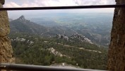
Some would say it is the least exciting, as it is easy to reach compared with the other two. However it has by far the best views, its summit standing on a pinnacle with views all round. The name "Kantara" in Arabic means a bridge or an arch. This is an appropriate name, as the castle is located at a point which bridges the mountain range and commands views of both the north and the south coasts. On a clear day, it is possible to see across both sides of the Karpaz peninsula, and on to the distant mountains of Turkey. In winter is sometimes possible to see the snows of Lebanon, over 160km away.
Buffavento and St Hilarion castles both have their queen legend, and Kantara is not to be outdone. Local legend has it that since the castle was abandoned 500 years ago, a ghostly queen can be seen, sitting by the Gothic window at the highest point, looking out over her country. Perhaps she is trapped here. Another local legend refers to the castle as the house of 101 rooms. The belief is that if someone was to enter they 101st room, they entered paradise, unable to return through the door to the castle.
The Castle Entrance
Very little is known of the castle's early days. It is thought to have been built by the Byzantines, probably after the last of the Arab raids in the late 10th century. However there are no remains or records dating from that time. Its first mention was in 1191, during Richard the Lionheart's Crusade to the Holy land. It was at Kantara that the self-styled king, Isaac Commenos, sheltered before surrendering to the English King.
We have much more information about the castle from the Lusignan and Venetian periods, which lasted from 1191 to 1571. In the 13th century, the castle was remodelled by the Lusignans, and during the next few hundred years, the castle often served as a shelter for defeated barons and kings. When the Genoese conquered Famagusta and Nicosia in 1373, Kantara remained undefeated in the hands of the King. It was here too, that Prince John, the king's brother, fled, disguised as a cook, after his escape from the Genoese. The story goes that the prince, having been captured in Famagusta with the rest of the Royal Family, was imprisoned in irons. With the aid of his faithful servant and cook, he escaped, dressed as the cook's scullion, with an old cooking pot over his head, and carrying a frying pan which he was supposedly taking to be re-tinned.
The North East Tower
After the peace treaty with the Genoese, Kantara was further re-fortified. Most of the castle that we see today dates from around this time.
When the Venetians took over the island in 1489, the castle continued as an important garrison for the defence of the area. However, the art of warfare was changing, and the Venetians strengthened the fortifications at Kyrenia, Famagusta and Nicosia. The castle was abandoned in 1525, though there are records showing the castle as still fortified in 1529. However records show the castle in ruins by 1562.
There are several routes you can take to Kantara castle, from either the northern or southern coastal roads. It will take you about 30 minutes of good, but narrow and twisty roads to get to the Village of Kantara, where you can stop and have some refreshments after your drive. From the north, the road through Kaplica, is by far the best, having recently been widened and upgraded (although no less twisty than the other routes!) Approaching from the south, the road from Iskele through Topcukoy and Ardahan has likewise been upgraded. The castle itself is about 10 minutes beyond the village.
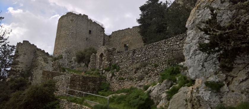
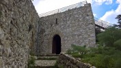
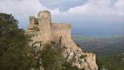
The approach to the castle is from the east. Sheer cliffs on the north, west and south make it virtually impossible to approach from those directions. Leaving the car park, you enter through a barbican which is placed at the centre of the eastern wall, and is protected by two square towers and leads into a large bailey. A second door, again protected by two towers, is the entrance to the actual castle.
The Top Tower
Turning to the right, you will come to the north-eastern tower. This tower, actually juts out a little from the rest of the castle walls, making it an ideal position to watch the comings and goings along the north coast. On the ground floor there is a passage leading to a square chamber. An entrance from this chamber leads to a horseshoe shaped vaulted tower with shooting slits on three sides. The top floor of the tower consists of a long, narrow passage ending in a rectangular chamber. from here you can reach the roof of the tower, which is surrounded by a parapet with loopholes.
To the left of the entrance, the southeast tower has a vaulted basement which was at first used as a prison, but later was turned into a cistern for rain water storage.
Beyond this tower, there is a group of three vaulted rooms with shooting slits. These were used as accommodation for the soldiers. At the end of these rooms is the medieval latrine used by the inhabitants.
It is interesting here, to reflect for a moment on the difference between Roman and Venetian latrines. Here we basically have a hole in a wall at the top of a cliff. A visit to Salamis shows that the Roman latrines had marble seats with arm rests, and were flushed by constantly running water!
View to the Karpaz from Kantara Castle
Continuing round to the southwest, you will see the remains of the southern wall, followed by some more towers and cisterns. At the most southern point here, you will see a small gate that could be used by the inhabitants in an emergency.
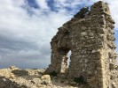
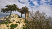
From here, a steep path takes you past the remains of the northern wall, and on to the highest point of the castle. All that remains of the tower here is part of its south wall with its window almost intact. Although the views from here are magnificent, the purpose of this tower was to keep a lookout for potential enemies, and for the lookouts to exchange messages with their opposite numbers at Buffavento.
Although it is many years since messages were passed by burning bonfires at the top of a mountain, the modern equivalent will have been spotted on your trip to Kantara. On the local mountain summits, you will easily spot radar and radio installations. The technology has changed, but it would appear that the danger still comes from the same direction.
Continuing in the same clockwise direction, the trip down to the castle entrance is much less daunting.
